The 2015 flooding of the Sagavanirktok River in northern Alaska had immediate consequences, including the closure of the Dalton Highway for several days. However, a recent study conducted by assistant professor Simon Zwieback at the University of Alaska Fairbanks Geophysical Institute reveals that the flooding also had significant long-term effects on the permafrost-rich region. The study, published in the journal Permafrost and Periglacial Processes, sheds light on the subsequent ground subsidence and the overall changes to the landscape. This article will analyze and discuss the study’s findings, highlighting both the immediate impacts and the lasting consequences of the 2015 flooding event.
The research conducted by Zwieback and his team revealed that the flooding caused diffuse and variable changes to both the tundra and the permafrost landscape. In areas that were flooded, there were hotspots of subsidence, with some areas experiencing ground sinking of over three inches within a few years. Additionally, the researchers observed a green-up and wettening of the landscape in flooded regions. These findings are crucial for understanding how these sensitive ecosystems respond to extreme flooding events.
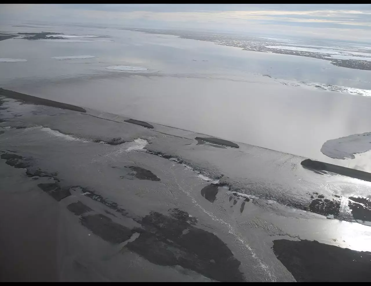
The flooding of the Sagavanirktok River was primarily attributed to a pre-flood buildup of aufeis, layered ice formed from the freezing of river water. The aufeis diverted water away from natural channels, exacerbating the floodwaters’ impact on the floodplains. This chaotic flooding highlighted the complicated relationship between rivers and floodplains in regions with continuous permafrost. Additionally, human activity in the area, driven by the expansion of the Prudhoe Bay oilfield and the presence of the Dalton Highway, further interfered with natural drainage. The flood itself could have triggered subsidence by warming the ground and causing ground ice to melt. Warming, in this case, could be caused by increased wetness, alteration to the protective organic layer, or sediment depositions that allow more heat to penetrate into the ground.
To estimate ground deformation over the years following the flood, Zwieback analyzed satellite data from 2015 to 2019. The results demonstrated widespread but variable subsidence, with the most significant subsidence occurring in flooded locations in the two years following the flood. The researchers interpreted this subsidence as primarily due to the melting of ground ice. The soils in the area contain considerable amounts of ice in the form of ice wedges and segregated ice. These ice wedges, typically found about 30 feet apart, play a significant role in the subsidence process.
Subsidence in the flooded regions depended on various factors beyond the presence of ice. Organic layer disturbance and sediment deposition were also found to contribute to ground deformation. Disturbance to the organic layer and the settling of sediment into the soil can displace insulating air pockets, allowing more heat to penetrate the ground. In specific locations, researchers identified fine-grain sediment in the top two inches of soil plugs, potentially from the flood. However, further investigation is needed to conclusively determine the source of this sediment. Additionally, subsiding ice-rich locations showed increases in greenness and wetness, while many ice-poor floodplains exhibited greening without deformation.
The study also highlights the potential long-term benefits of flooding in the region. Flooding events deposit sediment, which leads to an increase in insulating vegetation cover and organic matter. Over time, this process results in the thinning of the active layer, the layer of soil that freezes in winter and thaws in summer. Thinning of the active layer allows for the growth of ice wedges and segregated ice, which increases elevation and reduces flood frequency. These findings are particularly important as the Arctic faces increasing climate stresses, with wetter conditions and changing flood regimes. Understanding how riverine landscapes respond to these changes is crucial for future management and conservation efforts.
The 2015 flooding of the Sagavanirktok River in northern Alaska had both immediate and long-term impacts on the region’s permafrost-rich landscape. The flood led to ground subsidence and significant changes to the tundra and permafrost. Remote sensing techniques and analysis of satellite data revealed widespread subsidence, largely attributed to the melting of ground ice. Factors such as organic layer disturbance and sediment deposition also played a role in ground deformation. Understanding the long-term effects of flooding on riverine landscapes is crucial as the Arctic faces increasing climate stresses. These findings provide valuable insights into the complex relationship between rivers, floods, permafrost, and the overall response of Arctic ecosystems to environmental change.
Leave a Reply